


- L'Alt Berguedà
- How to get there
- Services
- Interest places
- Hiking
- Routes
- Tourism Information Offices
- Towns
- Quality
- Latest news
- Links
-
amb la participació de


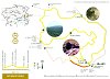
Sant Jaume de Frontanyà PR-C 51

This route is seldom travelled and is especially outstanding because of the landscape and the variety of vegetation. It runs mainly through extensive areas of pine wood, with oaks and holm oaks on the southern face and beech on the northern face. There is only one drawback: there is no reliable water spring along the route. You must plan ahead and carry enough water to last the whole route.
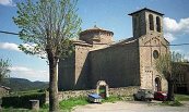
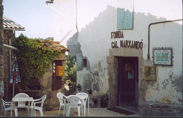
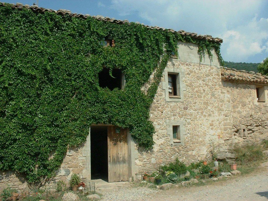
We suggest that, either before or after the route, you visit the church of Sant Jaume de Frontanyà, which is an exceptional example of Romanesque architecture. The key is at the Marxandó inn, right in front of the church.
Description
The route starts by going uphill to a small detour (signposted) that takes you to the cross of the Pla de les Forques crossing. It's well worth going up to take in the views of both the village and the surrounding mountains. There are vast panoramic views towards El Baix Berguedà and El Lluçanès. Turn back to the detour and continue along the route until you reach the cross ridge. You will soon come to a point where the ridge stretches out and becomes a wide grassy path that crosses the wood: this is the Pla de la Lleona plain, where there is an unmistakable monumental pine in the middle of the path.
Start the descent towards the Creu Melosa pass. From here you can reach the Coms spring, if you need water: go down the track on the left. You will shortly see the waymarks of the GR 4 and the spring near a junction of tracks. You cannot rely on this spring as it often dries up throughout the year. If you've had enough for now, from here you can follow the red and white waymarks going downhill to return to Sant Jaume de Frontanyà in a little less than an hour.
If you want to keep going along the route, go back to the Creu Melosa pass where there is a path that descends northwards. The beech grove is charming; go down at your leisure and enjoy it.
When you reach a track junction, the sign-posted path goes to the right. If you feel like it and have enough energy left, you can go up to the ruins of the Qüestió house. Take the track on the left that goes uphill for about 500 metres and then levels out. Here there is an electricity pylon on the right, at the foot of the track. With the pylon behind you, you will see a path going uphill to the left of a shoulder. The ruins of the Qüestió house are behind this shoulder. This is a nice quiet place to have a rest and admire the descent.
Return to the sign-posted path and you then have to keep walking until you reach the road. Before reaching the road, the path crosses a stream where there is a spring, which will probably be dry, especially if it's summer. When you reach the Batallola pass, downhill on the left, you will see the ruins of the old Batallola house. Only the remains of walls are left.
From here, you have to walk along a stretch of road. This is the price to pay when connecting mountain villages. It is only a short walk, and mostly downhill.
At the pass itself, the path turns right and goes down along the old trail. Now that you are on the final stretch, all downhill, have a good look at the path. It is clean and clear, but not due to the actions of man. Every now and then, you see leaves and soil caught behind small obstacles. They have been dragged there by the rainwater entrusted with keeping the path clean and unobstructed.
Route recommended by:
| Distance | 9 Km. |
|---|---|
| Route number | 11 |
| Starting point | Davant l'església de Sant Jaume de Frontanyà |
| Zone | Sant Jaume de Frontanyà |
| Time | 3 h. |
| Signals | Marques grogues i blanques en tota la ruta |
| Bibliography | Catalunya Romànica, volum XII, El Berguedà. |
| Ending point | Davant l'església de Sant Jaume de Frontanyà |
| maximum altitude | 1380 m. |
| Cartography | El Berguedà 1:50.000 de l'institut cartogràfic de Catalunya. /vcMontgrony - Fonts del Llobregat 1:25.000 de l'Editorial Alpina. |
| Comments | El Consorci de Turisme de l'Alt Berguedà no es responsabilitza dels accidents o danys que puguin patir els usuaris durant la realització d' aquesta ruta així com tampoc de les deficiències de senyalització que, ocasionalment, hi puguin haver |

Documentation attached
Culture
Nature
Center items on the map
Comments

